

Neighborhood Guide · Palm Beach, FL
North End
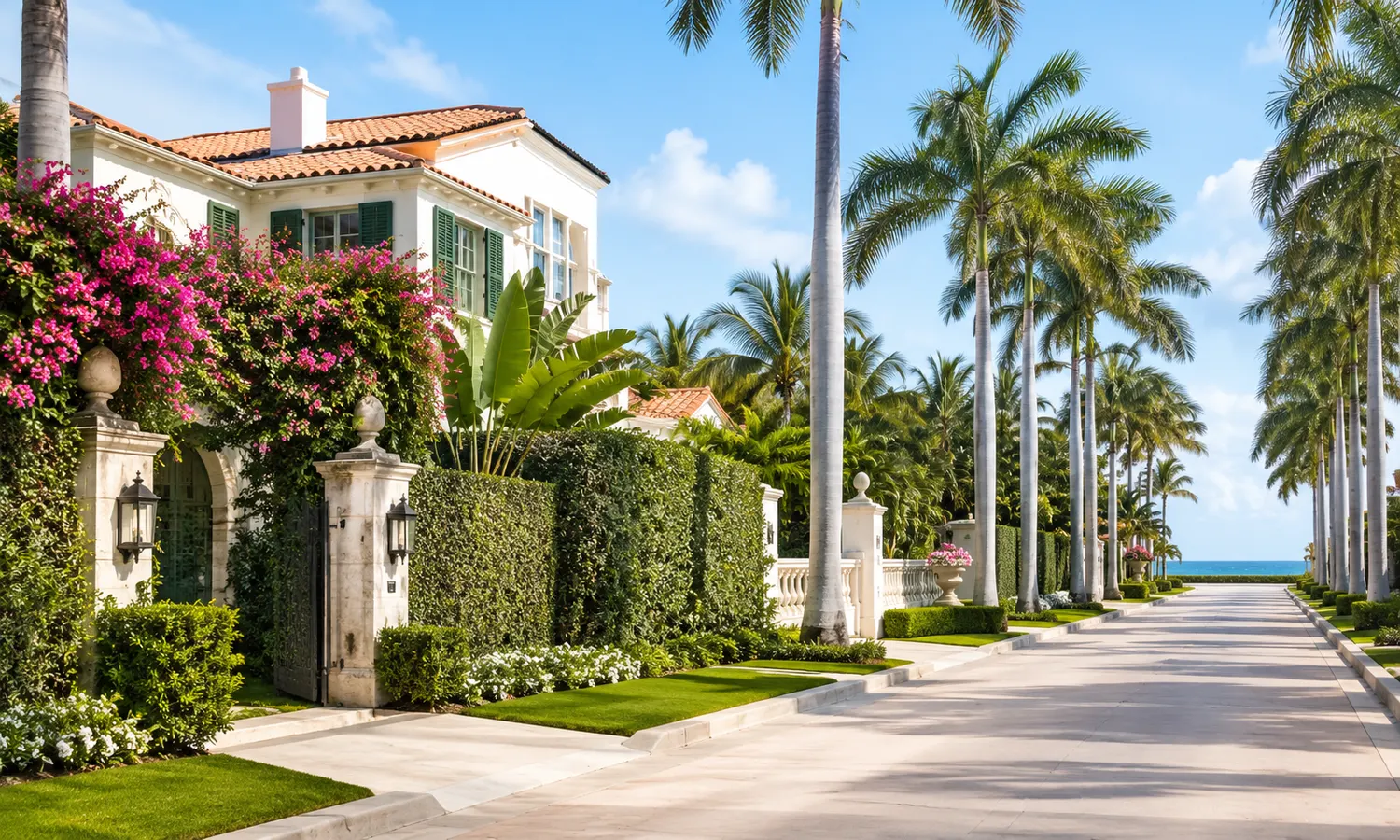
The North End is the informal name for the northern portion of the Palm Beach barrier island — a primarily residential stretch reaching toward the Lake Worth Inlet, north of the Town’s Royal Poinciana Way commercial area.
Reviewed by · Last updated
- Property types
- Primarily single-family residential
- Waterfront
- The island narrows here, with the Lake Worth Inlet forming its northern edge
- Getting around
- The Lake Trail runs north along the lagoon side to the North End
- To PBI Airport
- 3.5 miles — PBI is 3.5 mi west of Palm Beach
North End overview
The North End is how the northern part of the Palm Beach barrier island is commonly described, including by the Town itself — the Comprehensive Plan refers to “the North End of the Island,” and the Town describes the Lake Trail as running to “the North End of the island.” What does not exist, in any source we could find, is an official boundary. No Town ordinance, map or plan we read defines its extent, so this guide does not draw one. The closest thing to a stated limit is the scope of a single 2014 study funded by the Preservation Foundation of Palm Beach, which examined demolitions and new construction between October 2008 and July 2014 and identified 72 structures “within the area extending from the northern tip of the island to Sunset Avenue.” That is one study’s area of inquiry, not a neighborhood line.
The geography is unusually tight. The Town of Palm Beach occupies a barrier island 12.28 miles long and roughly 2,432 acres in total, and at no point is it wider than three-quarters of a mile — in places it narrows to only 500 feet. The Town is surrounded by water on three sides: the Lake Worth Lagoon and Intracoastal Waterway to the west, the Atlantic to the east, and the Lake Worth Inlet to the north. That inlet is what gives the north of the island its edge, and it also shaped the ground: the Comprehensive Plan notes that most native sandy soils sit along the beach ridge and, in the north end of Town, directly behind it.
The island’s recorded history begins with permanent pioneers arriving in 1872, and the name traces to an 1878 shipwreck, the Providencia, whose coconut cargo settlers planted. The pioneer era ended in 1894 with the opening of Henry Flagler’s Royal Poinciana Hotel, followed by the Florida East Coast Railroad in 1896, and the Town of Palm Beach was incorporated on April 17, 1911 with Elisha N. Dimick elected as its first mayor. One detail specific to this part of the island is worth keeping in mind when looking at houses: the Comprehensive Plan records that homes in the North End averaged 2,500 to 3,000 square feet or less from the 1930s through the 1970s — well below the 6,000 square feet the Town’s zoning code allowed at the time.
The inlet has also driven a century of coastal engineering. Beach erosion has been a continuing problem for the Town since 1924, when the Lake Worth Inlet was deepened and stabilised with jetties on either side. Sand immediately began building up against the north jetty; beaches on the north side of the inlet began to accrete, while those to the south — where the Town lies — suffered erosion. Drainage has been addressed too: the Town records that in 2000 and 2001 a number of residential neighbourhoods in the north end of Town experienced severe flooding during heavy rainfall.
Location within Palm Beach
The North End occupies the northern portion of the island, reaching toward the Lake Worth Inlet. Because the island is narrow throughout, properties here sit close to both the Atlantic on the east and the Lake Worth Lagoon on the west.
Immediately south of the residential streets is what the Town calls its northern commercial area, encompassing Royal Poinciana Way, Sunrise and Sunset Avenues, Bradley Place, North County Road and the Royal Poinciana Plaza, with a concentration of retail and restaurants.
The Flagler Memorial Bridge — which the Town notes is referred to locally as the “north bridge” — is the closest crossing to the mainland from this part of the island.
Notable features
- Lake Worth Inlet
- The waterway forming the northern edge of the Town. Deepened and stabilised with jetties in 1924, an intervention that has shaped the island’s shoreline ever since.
- North County Road Tree Canopy
- A Town-designated scenic landmark, designated 15 January 2014.
- Wells Road Scenic Vista
- A Town-designated scenic vista, designated 9 January 1996.
- Coral Cut Historic District
- A Town-designated historic district, designated 2 April 1987. The Comprehensive Plan describes the Coral Cut as an early Town stormwater-management and site-planning work.
- Flagler Memorial Bridge Historic District
- A Town-designated historic district, designated 14 March 1989, at the island’s northern crossing to West Palm Beach.
- Casa Bendita — Mizner Wall
- A Town landmark at 120 Casa Bendita, designated 11 January 2000 — one of the few authoritatively documented Addison Mizner links in this part of the island.
Real estate in North End
The North End is primarily residential, and the Town’s zoning framework is the most reliable guide to what can be built. The Comprehensive Plan maps single-family land use to three districts — R-AA Large Estate Residential, R-A Estate Residential and R-B Low-Density Residential — and describes R-B as the predominantly single-family area of the Town. The zoning map sheet covering the northern streets shows R-B, R-A, R-AA and BA (Beach Area) districts. We are deliberately not assigning a district to any particular street: that should be confirmed per address with the Town, and we could not verify minimum lot areas or widths, because the Town’s summary of district regulations was unavailable.
One constraint worth knowing early is the Cubic Content Ratio, which the Town applies to the R-B district only. Where it applies it governs overall building volume rather than just footprint or height, and it is the kind of rule that reshapes a project after an offer rather than before it.
Scale is the other defining theme. Against a zoning code that historically permitted 6,000 square feet, houses in the North End averaged 2,500 to 3,000 square feet or less from the 1930s through the 1970s — which is the backdrop to the redevelopment pattern the Preservation Foundation studied, identifying 72 demolitions and new constructions in the north of the island between October 2008 and July 2014. Many individual addresses on northern streets — among them properties on North Ocean Boulevard, North Ocean Way, North Lake Way, Algoma Road, Dunbar Road, Onondaga Avenue, Orange Grove Road, Queens Lane, Tangier Avenue, Hi Mount Road and Wells Road — carry Town landmark designation or are listed as Historically Significant Buildings. Confirm a specific property’s status with the Town before planning any exterior work.
On price, our position is the same across every guide on this site: no authoritative public source publishes home sale prices for the North End, for ZIP 33480, or for the Town of Palm Beach. The aggregator figures that do circulate for this area contradicted one another substantially when checked, which is precisely why we do not repeat them. The one authoritative, dated figure available measures the whole municipality’s tax base rather than any home: the Palm Beach County Property Appraiser recorded the Town of Palm Beach’s 2025 final taxable value at $34,666,851,802, up 8.20% from the prior year. Christian works from verifiable comparables instead, and will show you the source and date behind each figure.
Lifestyle in North End
Day-to-day life in the north of the island is residential and quiet in character, with the Town’s northern commercial area — Royal Poinciana Way, Sunrise and Sunset Avenues, Bradley Place, North County Road and the Royal Poinciana Plaza — providing the nearest concentration of retail and restaurants. The Town also maintains an unusually dense network of small parks through these streets.
Parks
- Bradley Park 4.2 acres at the northwest corner of Royal Poinciana Way and Bradley Place — the largest park in this part of the island.
- Palmo Park 2.1 acres on the north side of Palmo Way, between North Lake Way and North Ocean Way.
- Wrightsman Estate Park 0.77 acres at the southwest corner of Tangier Avenue and North County Road.
- Dean Park 0.48 acres at the northwest corner of Tangier Avenue and North County Road.
Show 4 more
- Boyd Park 0.14 acres at the southwest corner of Bahama Lane and North Ocean Boulevard.
- Annie’s Dock (Palm Beach Inlet Dock) 0.12 acres, located north of East Inlet Drive and North Ocean Boulevard.
- Crescent Park 0.10 acres at the northwest corner of Crescent Drive and North County Road.
- Wells Mini Park 0.04 acres on either side of Crescent Drive at North County Road, across from the North Fire Station.
Shopping & dining
- Royal Poinciana Way Part of the Town’s northern commercial area, with a concentration of retail and restaurants.
- Royal Poinciana Plaza A retail and dining destination in the northern commercial area.
- North County Road Runs through the northern commercial area and up into the residential streets.
- Sunrise & Sunset Avenues Also within the Town’s northern commercial area.
The Lake Trail
- Runs to the North End The Town describes the trail as taking bikers, joggers and walkers from the Royal Park Bridge to the North End of the island.
- Published lengths differ The Town’s New Residents page calls it “nearly six-mile”; the Comprehensive Plan describes a 5.5-mile linear park ending just north of the Sailfish Club, while the same Plan’s facilities table lists 4.7 miles. Treat the figure as approximate.
Recreation
- Town Marina Town-operated, with 84 slips per the Comprehensive Plan.
- Mandel Recreation Center Town-operated recreation centre.
- Seaview Park Tennis Center A Town-operated tennis facility.
Getting around
- Flagler Memorial Bridge The nearest crossing, known locally as the “north bridge.” At mile 1021.8; opens on the quarter and three-quarter hour, with reduced weekday peak openings.
- Royal Park & Southern Boulevard bridges The other two crossings to West Palm Beach, at miles 1022.6 and 1024.7.
- Robert A. Harris Memorial Bridge A fourth bridge, on Lake Worth Road, connecting the Town to the City of Lake Worth Beach.
- Presidential Security Zone Federal rules provide for altered or suspended bridge openings when the security zone is enforced. Check current federal regulations before relying on a schedule.
Nearby schools
Public schools
-
A School District of Palm Beach County middle school at 3630 Parker Avenue in West Palm Beach.
-
A School District of Palm Beach County high school at 6901 Parker Avenue in West Palm Beach.
- Palm Beach Public Public
The public elementary school on the island, at 239 Cocoanut Row in the Town of Palm Beach. Part of the School District of Palm Beach County.
Private schools
- Palm Beach Day Academy Private
An independent school with its Grades 4–8 campus on the island at 241 Seaview Avenue, and its PreK-2 through Grade 3 campus at 1901 South Flagler Drive in West Palm Beach.
- Rosarian Academy Private
An independent, coeducational Catholic school at 807 North Flagler Drive in West Palm Beach, sponsored by the Adrian Dominican Sisters.
- The Benjamin School Private
An independent school with its Lower and Middle School at 11000 Ellison Wilson Road, North Palm Beach, and its Upper School at 4875 Grandiflora Road, Palm Beach Gardens — verified on the school’s own site.
School information is provided for reference only and can change. Attendance boundaries, grade levels, and admissions are set by each school and district — confirm details directly with the school. Nothing here is a rating or an endorsement.
Nearby communities
North End questions, answered
-
Where is the North End of Palm Beach?
- The North End is the northern portion of the Palm Beach barrier island, in the Town of Palm Beach, Palm Beach County, Florida. It reaches toward the Lake Worth Inlet, which forms the Town’s northern edge — the Town is surrounded by water on three sides, with the Lake Worth Lagoon and Intracoastal Waterway to the west, the Atlantic to the east and the inlet to the north. The island as a whole runs 12.28 miles and covers roughly 2,432 acres, and it is never wider than three-quarters of a mile, narrowing in places to just 500 feet, so properties here sit close to water on both sides. Immediately south of the residential streets is the Town’s northern commercial area along Royal Poinciana Way, Sunrise and Sunset Avenues, Bradley Place and North County Road.
-
Does the North End have official boundaries?
- No — and this is worth being precise about, because plenty of sources will tell you otherwise. The Town of Palm Beach uses the phrase informally: its Comprehensive Plan refers to “the North End of the Island,” and the Town describes the Lake Trail as running to “the North End of the island.” But no Town ordinance, map or plan that we read defines its extent. The commonly repeated line that the North End runs from Wells Road to the Palm Beach Inlet appears only in real-estate marketing, not in any Town source, so we do not state it. The nearest thing to a documented limit is the scope of a 2014 Preservation Foundation study, which examined the area “from the northern tip of the island to Sunset Avenue” — a study area, not a boundary. For anything that depends on a precise line — zoning, tax district or school assignment — confirm the specific address with the Town, the Property Appraiser or the School District.
-
What kinds of homes are in the North End?
- It is primarily single-family residential. The Town’s Comprehensive Plan maps single-family land use to three zoning districts — R-AA Large Estate Residential, R-A Estate Residential and R-B Low-Density Residential — and describes R-B as the predominantly single-family area of the Town. The zoning map sheet covering the northern streets shows R-B, R-A, R-AA and BA (Beach Area) districts, though we are not assigning a district to any particular street, since that requires a parcel-level check. On scale, the Comprehensive Plan records that homes in the North End averaged 2,500 to 3,000 square feet or less from the 1930s through the 1970s, against a zoning code that then allowed 6,000 square feet. One rule to raise early with any architect: the Town applies a Cubic Content Ratio to the R-B district, governing overall building volume rather than footprint alone.
-
Are there historic landmarks in the North End?
- Yes, a considerable number. The Town of Palm Beach maintains a list of landmarks and Historically Significant Buildings, and streets in the north of the island are well represented — including addresses on North Ocean Boulevard, North Ocean Way, North Lake Way, Algoma Road, Dunbar Road, Onondaga Avenue, Orange Grove Road, Queens Lane, Nightingale Trail, Tangier Avenue, Hi Mount Road and Wells Road. There are also area-wide designations: the North County Road Tree Canopy (2014), the Wells Road Scenic Vista (1996), the Coral Cut Historic District (1987) and the Flagler Memorial Bridge Historic District (1989). One Addison Mizner link is authoritatively documented here — the Mizner Wall at 120 Casa Bendita, designated in 2000. Note that no National Register-listed property was identified in the far north of the island; Mar-a-Lago, often mentioned in this context, is on South Ocean Boulevard.
-
How long is the Lake Trail?
- Honestly, it depends which Town document you read — and we would rather tell you that than pick a number and present it as settled. The Town’s New Residents page describes the “nearly six-mile Lake Trail,” taking bikers, joggers and walkers from the Royal Park Bridge to the North End of the island. The Town’s Comprehensive Plan, however, describes the Lake Trail Linear Park as 5.5 miles long, extending from South Lake Drive near Peruvian Avenue north to its terminus just north of the Sailfish Club — and the facilities table within that same Plan lists it as 4.7 miles. All three figures come from the Town itself. Treat the length as approximate, somewhere in the region of five to six miles, and expect the trail to reach the north of the island whichever measurement you use.
-
What shops and restaurants are near the North End?
- The nearest concentration is what the Town’s Comprehensive Plan calls its northern commercial area, which encompasses Royal Poinciana Way, Sunrise and Sunset Avenues, Bradley Place, North County Road and the Royal Poinciana Plaza, described as holding a concentration of retail and restaurants. That area sits immediately south of the North End’s residential streets, which is part of what makes this part of the island practical day to day — you are not crossing a bridge for ordinary errands. Further south on the island, the Worth Avenue District is the Town’s historic shopping and dining street. We have not listed individual businesses here, because tenancies change and we only publish details we can verify against a primary source at the time of writing.
-
How do you get off the island from the North End?
- By bridge. The Town notes three bridges lead from West Palm Beach over to Palm Beach: the Flagler Memorial Bridge — referred to locally as the “north bridge” and the closest to this part of the island — the Royal Park Bridge, known as the “middle bridge,” and the Southern Boulevard Bridge. A fourth, the Robert A. Harris Memorial Bridge on Lake Worth Road, connects the Town to the City of Lake Worth Beach. All are drawbridges operating on federally published schedules: the Flagler Memorial at mile 1021.8 opens on the quarter and three-quarter hour, with reduced openings during weekday peaks. Federal rules also provide for altered or suspended openings when the Presidential Security Zone is enforced, so check current regulations rather than assuming a fixed timetable. The airport is 3.5 miles west of Palm Beach.
-
What do homes cost in the North End?
- We do not publish a figure, and in this case the reason is especially concrete. No authoritative public source publishes sale prices for the North End, for ZIP 33480, or for the Town of Palm Beach. When we checked the aggregator sites that do quote numbers for this area, they contradicted one another dramatically — differing by millions for what was ostensibly the same geography — which is exactly why repeating any of them would be misleading. The one authoritative, dated figure that exists measures something else entirely: the Palm Beach County Property Appraiser recorded the Town of Palm Beach’s total taxable value at $34,666,851,802 on the 2025 final tax roll, up 8.20% from the previous year. That is the assessed tax base of the entire municipality, not the price of a house, and it cannot be averaged into one. For a real answer, Christian will pull verifiable comparables and show you the source and date for each.
Homes for sale in North End
No listings in North End right now
Authorized listings appear here as they come to market. Christian can also watch this area for you and send matches as soon as they surface.
Recently viewed
Sources & references 17
Facts on this page are drawn from the following sources, accessed as of the date noted.
- Town of Palm Beach — New Residents Guide — as of 2026-07-21
- Town of Palm Beach — History of Palm Beach — as of 2026-07-21
- Town of Palm Beach — Comprehensive Plan — as of 2026-07-21
- Town of Palm Beach — Landmarks & Historically Significant Buildings list (rev. 06/03/2025) — as of 2026-07-21
- Town of Palm Beach — Zoning Legend form — as of 2026-07-21
- Historical Society of Palm Beach County — Architects of the Boom & Bust — as of 2026-07-21
- 33 CFR § 117.261 — Drawbridge operation regulations (Cornell LII) — as of 2026-07-21
- Palm Beach International Airport (PBI) — About — as of 2026-07-21
- Palm Beach County Property Appraiser — 2025 Final Taxable Value — as of 2026-07-21
- NCES Common Core of Data — public school search, ZIP 33480 — as of 2026-07-21
- Palm Beach Public — as of 2026-07-21
- Conniston Community Middle School — School Information — as of 2026-07-21
- Forest Hill Community High School — School Information — as of 2026-07-21
- Palm Beach Day Academy — At a Glance — as of 2026-07-21
- The Benjamin School — as of 2026-07-21
- Rosarian Academy — as of 2026-07-21
- OpenStreetMap / Nominatim — North Ocean Boulevard, Palm Beach (map coordinates) — as of 2026-07-21
Let's talk
Thinking about buying or selling in North End?
Schedule a private consultation, view available homes, or get neighborhood market updates as they're published. Christian follows up personally.